


Orca: Boat GPS, Charts, Routes
3.929.00 Reviews
App Specs
- Version
- 2026.17.2
- Updated On
- License
- Free
- Downloads
- 100,000+
- Developer
- Orca Technologies AS
- Categories
- Maps & Navigation
- Platform
- Android
Screenshots
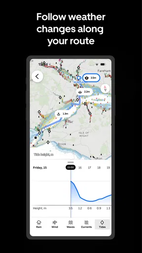
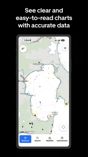
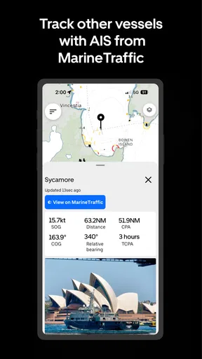
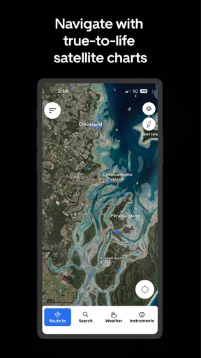
 Analysis by AppCompare
On the water, a navigation app can feel wonderfully reassuring—until a screen stops loading or you realize you have not checked what depends on a connection. That tension is central to using Orca: Boat GPS, Charts, Routes: it brings charting, route planning, GPS, weather and AIS into a boating-focused tool, but I would treat any phone app as one part of a careful navigation routine, not as a substitute for judgment or suitable backup equipment.
When the network becomes part of the trip
Connectivity matters most before departure and whenever you want information that may change. Weather is useful for deciding whether to go and for keeping an eye on conditions, while route and chart information help turn a general destination into a practical plan. I would check the areas and details I need while I have a dependable connection, then make sure I understand how the app behaves on the water rather than assuming every screen will remain available in every signal condition.
That distinction is worth keeping in mind because a phone can show its GPS position without having a strong mobile connection, while other information may rely on data arriving over a network. Those are different jobs. I would not interpret a moving position marker as proof that weather, chart updates or other live information are current. If a detail is important to a safe decision, check when it was refreshed and consider another source as well.
A boat app has to work in more than one setting
Using navigation software at a desk is different from using it in a moving boat. Sun glare, wet hands, vibration and the need to look up at the water all make long interactions awkward. I prefer to do the fiddly work—choosing a destination, reviewing a route and checking the forecast—before leaving the dock. On board, the app is more useful when I can glance at it briefly and return my attention to the surroundings.
A practical habit is to set up a route with recognizable waypoints rather than relying only on a destination name. That gives you useful checkpoints for comparing the plotted plan with what you see around you. It also makes a route easier to discuss with someone else aboard. Orca’s route planning and GPS are a natural fit for this workflow, though I would still cross-check the intended passage against local knowledge and the conditions on the day.
For a short outing, a phone may be a convenient planning and reference tool. For longer or more exposed trips, I would be more cautious about relying on a single handheld device: battery use, visibility and access to current information all matter. The right setup depends on the boat and journey, and a dedicated marine display or another navigation method may be a better primary reference for people who routinely travel far from shore.
What I would do if something stops working
The most useful safety feature is often a plan for when the app is not behaving as expected. If a chart, forecast or route does not appear to update, I would avoid making a consequential change based on a screen that may be stale. I would check the connection, confirm the app is showing the intended area, and compare my position and surroundings with another dependable reference before proceeding.
Worth Reading Before You Choose

Flipboard Shows What News Apps Must Do Beyond the Feed

Switching to Android Auto Means Rethinking Your Driving Routine

Google Calendar Makes a Crowded Week Easier to Manage

Ludo King Makes the Most of the Minutes Between Plans

Baby Panda World Brings Quick Play to Modern Phones, but Its Game Library Feels Busy

ESPN’s Live Game View Makes Following Close Games Easier
Before setting out, it is sensible to keep the phone charged and easy to reach, and to tell someone aboard how to find the route and key information. If the device becomes unavailable, the crew should still know the destination and the basic plan. An app can make navigation more convenient, but that convenience is not the same as a backup. I would not count on a phone alone for emergency communication or assume a saved contact guarantees help in every situation.
Using data with a little more care
For a data-conscious routine, I would use a stable connection to prepare, avoid repeatedly refreshing screens without a reason, and pay attention to whether live details are current. That is not a promise that every chart or feature is available without a network; it is simply a sensible way to avoid discovering a connectivity problem at the moment I need to make a decision. If you expect to cruise beyond reliable coverage, test your intended workflow beforehand and bring a suitable alternative.
Weather, route planning and AIS are useful categories of information, but they answer different questions. A forecast helps with conditions; a route helps organize a passage; AIS can contribute to awareness of vessel traffic. None replaces watching the water, checking navigation marks or understanding local hazards. I find that distinction especially important for newer boaters, who may be tempted to treat a single app display as a complete picture.
Setting Sail with Orca
First things first, getting started with Orca: Boat GPS, Charts, Routes was a breeze. The interface is super intuitive, and even if you’re not tech-savvy, you’ll feel right at home. The app is available on both Android and iOS, so no matter what device you’re rocking, you’re covered. I downloaded it from the App Store, and it was smooth sailing from there.
Charting Your Course
One of the standout features of Orca is its detailed nautical charts. Seriously, these charts are top-notch. Whether you’re navigating familiar waters or exploring new shores, the charts are incredibly detailed and easy to read. I was impressed by the level of detail and accuracy, which is crucial when you’re out on the water.
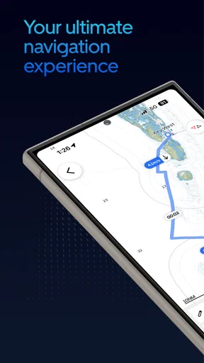
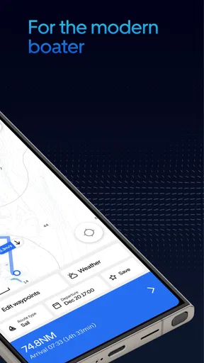
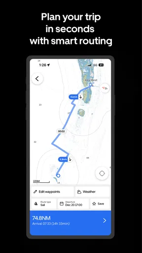
What’s cool is that you can customize your routes. Planning a day trip or a longer voyage? Orca’s got you covered. I loved how I could plot my course and see all the necessary details, like waypoints and distances. It’s like having a map that updates in real-time, which is super handy.
GPS That Knows Its Stuff
Now, let’s talk about the GPS functionality. Orca does a stellar job tracking your location. The real-time updates are spot-on, which gives you peace of mind knowing exactly where you are at all times. I tested it out on a sunny afternoon, and the app didn’t skip a beat.
Another nifty feature is the automatic rerouting. If you happen to stray off course, Orca recalculates your route faster than you can say "Ahoy!" It’s like having a second set of eyes looking out for you, making sure you stay on track.
Weather Woes No More
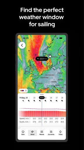
No sailor likes to be caught off guard by unexpected weather changes. Thankfully, Orca has a built-in weather feature that keeps you updated on the latest conditions. I found this particularly useful when planning my outings. Knowing the weather forecast helps you make informed decisions, ensuring a safer and more enjoyable trip.
The app provides real-time updates on wind speed, temperature, and other essential weather data. It’s like having a mini weather station right there in your phone, which is honestly a game-changer.
All About Safety
Safety is a top priority when you’re at sea, and Orca doesn’t skimp on safety features. The app offers alerts for hazards, like shallow waters and rocks, to keep you safe. I tested this feature by intentionally setting a course close to known obstacles, and the app promptly alerted me. It’s reassuring to know that Orca has your back.
Additionally, the app allows you to save emergency contacts. Should you find yourself in a sticky situation, help is just a tap away. It’s these little touches that make Orca a reliable companion for any seafarer.
How it fits into a real outing
Imagine planning a relaxed afternoon trip to a familiar bay. Before casting off, I would use the route tools to mark the intended destination and a couple of sensible checkpoints, then review the chart and weather rather than waiting until the boat is underway. Once moving, GPS can help me monitor progress, while the route gives the person at the helm a reference point. If conditions shift, I would use the forecast as one input and reassess the plan against what is actually happening outside.
This is where the app’s combination of functions feels more useful than opening a general road map or switching between unrelated phone tools. A standard map app is designed around roads and land travel; a boating tool is better suited to chart-based planning and the concerns of a water route. Still, a dedicated marine display can be preferable for a skipper who needs a larger, permanently mounted screen or a familiar onboard system. Orca makes more sense as a flexible companion than as an automatic replacement for every piece of marine equipment.
Who will get the most from it
I can see Orca suiting recreational boaters who want route planning, chart viewing and trip information together on a phone, especially when they like to prepare before leaving. It may also appeal to someone learning to plan outings who wants waypoints and distances visible in one place. The app’s broad scope is convenient, but it does not remove the need to learn the area, watch conditions and understand what each display can—and cannot—tell you.
On the other hand, I would hesitate to recommend relying on it as the sole navigation setup for a long passage, a trip in challenging conditions or a boat where a phone is difficult to use safely. Someone who only needs directions on land will get little value from a marine-focused app. And if your priority is a simple chart viewer without a broader set of boating tools, a more specialized alternative may feel less busy. The best choice depends on how you boat, not just how many features appear on a screen.
Cost, compatibility and expectations
Orca is a free app from Orca Technologies AS, with in-app purchases listed from $44.99 to $159.99 per item. I would explore the free experience first and check carefully which capabilities matter to my own routes before considering a purchase. Those in-app prices make it especially sensible to decide what you need rather than paying simply because a feature sounds useful in theory.
It has an average rating of 3.9 from around 2,200 ratings, and has been installed over 100,000 times. That gives a prospective user some context, but ratings cannot tell you whether the app suits a particular boat, phone or cruising area. It is rated for Everyone, was released on May 4, 2021, and its current version is 2026.8.1; Android 8.0 is the stated minimum. Before installing, I would check that the device I plan to take aboard meets that requirement and has enough battery capacity for the outing.
Where I land on connectivity
My main advice is to prepare on shore, distinguish live information from position tracking, and avoid treating a phone as the only safety net. Orca brings several useful boating functions into one app, and that can make planning and keeping track of a route less fragmented. Its value is strongest when you use it deliberately: check the route before departure, keep an eye on conditions, and retain another way to navigate if the screen or connection lets you down.
Wrapping Up the Voyage
In conclusion, Orca: Boat GPS, Charts, Routes is a must-have for anyone who loves spending time on the water. It’s packed with features that enhance your boating experience, from detailed charts to real-time GPS tracking and weather updates. Whether you’re a seasoned sailor or a weekend warrior, Orca makes navigation a breeze.
So, if you’re ready to chart your next adventure, give Orca a try. It’s like having a pocket-sized navigator that you’ll wonder how you ever sailed without. Happy sailing, and may your journeys be as smooth as the app itself!
Pros
- Intuitive user interface for easy navigation.
- Highly accurate GPS tracking on water.
- Comprehensive chart updates regularly.
- Offline mode for areas with no signal.
- Customizable routes for personalized trips.
Cons
- Requires a stable internet connection initially.
- Battery drain is significant during long use.
- Limited in-app support for technical issues.
- Subscription model for premium features.
- May lag on older devices.
FAQs for Orca: Boat GPS, Charts, Routes
What features does Orca: Boat GPS, Charts, Routes offer?
Orca offers comprehensive marine navigation tools, including real-time GPS tracking, detailed nautical charts, and customizable route planning. Users can also access weather updates, tide forecasts, and AIS tracking for nearby vessels. The app is designed to enhance safety and efficiency for both recreational and professional mariners.
Is Orca compatible with both Android and iOS devices?
Yes, Orca is available for download on both Android and iOS platforms. It is optimized to run smoothly across various devices, ensuring a consistent experience whether you're using a smartphone or tablet. Users can access the app via the Google Play Store or the Apple App Store.
Does Orca require an internet connection to function?
Orca primarily relies on GPS data, which is available offline. However, for features like real-time weather updates and AIS tracking, an internet connection is necessary. Users can download charts and routes for offline use, making it a reliable tool even in remote areas without cellular coverage.
How user-friendly is the interface of Orca for beginners?
Orca is designed with a user-friendly interface, making it accessible for both beginners and experienced mariners. The app includes a comprehensive tutorial for new users, guiding them through its features. Intuitive navigation and clear icons ensure users can easily access the tools they need while out at sea.
Are there any subscription fees or in-app purchases in Orca?
Orca offers both free and premium versions. The free version includes basic navigation and charting features, while the premium subscription provides advanced functionalities such as detailed weather updates and expanded chart areas. In-app purchases are available for additional features or chart sets, allowing users to customize their experience.


